Skip to content
Skip to content
On the Road in Mexico

A survival guide for road travel in Mexico by Bill and Dorothy Bell

  • Home
  • Mexico Auto/RV Insurance
  • Planning Your Trip
  • Articles
  • Archeology
  • Places in Mexico
On the Road in Mexico

A survival guide for road travel in Mexico by Bill and Dorothy Bell

Tehuacán, Puebla

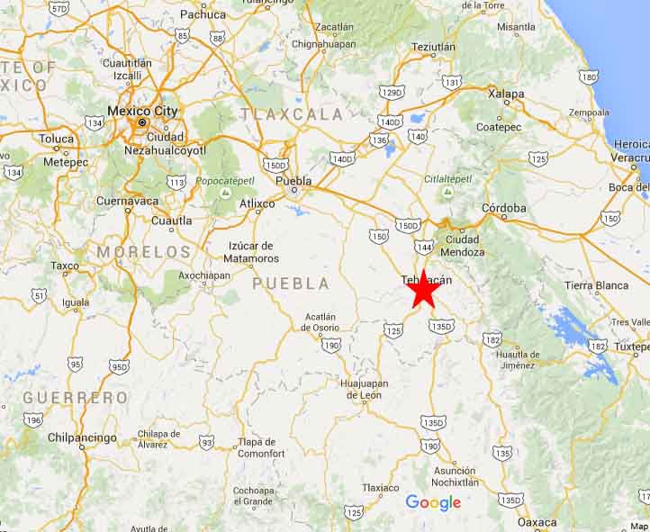
Tehuacan Map 1Tehuacán, Puebla

Techuacan coaName: Tehuacán the name of the Zapotec-ancestor island, at the mouth of the Lempa River (El Salvador) It was called Teoahkan.

Location: South central Mexico, South east of Puebla City in the state of Puebla.

Weather: Local steppe climate.

Weather Today in Tehuacan

January Average Highs 24C (75F) Lows 9C (48F)

July Average Highs 25C (77F)   Lows 15 (59F)

Population: 275,000 Second largest city in the state of Puebla

Elevation: 1,600 m (5,200 ft)

Founded: Founded in 1540 by the Spanish

Medical: Hospitals, doctors, dentist

Money: Banks

History:

Today:

Getting there:

From Puebla drive highway 150 south East.

From Oaxaca drive 135 North to Tehuacan.

Accommodation

HOTELS

Tehuantepec


NO RV PARKS NEARBY


 Tehuacan Mpa 2


©2026 On the Road in Mexico | WordPress Theme by SuperbThemes

Powered by
►
Necessary cookies enable essential site features like secure log-ins and consent preference adjustments. They do not store personal data.
None
►
Functional cookies support features like content sharing on social media, collecting feedback, and enabling third-party tools.
None
►
Analytical cookies track visitor interactions, providing insights on metrics like visitor count, bounce rate, and traffic sources.
None
►
Advertisement cookies deliver personalized ads based on your previous visits and analyze the effectiveness of ad campaigns.
None
►
Unclassified cookies are cookies that we are in the process of classifying, together with the providers of individual cookies.
None
Powered by