|
Home
Regions
Planning & Info
RVing Archeology
Articles
Road Logs Insurance Photos Mexico News Ontheroadin |

|
Santa Ana, Sinaloa By Dorothy Bell
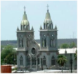
Our Lady of Saint Ana
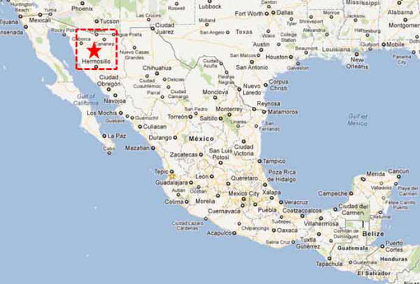
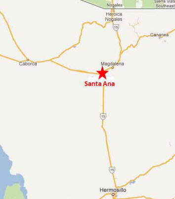
Santa Ana, Sonora Location 105 kms (65 miles) South of Nogales on Highway 15 Population 11,000 people in the city, 15,000 in the municipality Climate: DRY and Hot. Santa Ana lies in the Sonoran Desert 29.1 ° C in July-August, a minimum average monthly temperature of 12.4 ° C in December to February, Rainfall occurs in the months of July and August with an average annual rainfall of 332 mm, Frost appears in February and March.
History Santa Ana is and has always been an important crossroad. The Pima Indians populated the Magdalena River Valley and settled into an area called Santa Ana Viejo once the Spanish arrived and a Mission was established. The town was founded in 1883 with the building of the Sonoran Railway. It was given municipal status in 1935.
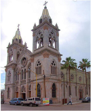
Santa Ana is not a major stopping spot for tourists. Perhaps the most notable building is the Gothic Church “Our Lady of Saint Ana.” An old 18th century structure with grand beautiful arches. In July the town celebrates Saint Ana Day, a regional fair which runs from 17 to 26 June Industry Agriculture and animal husbandry are the main economic activities. Main crops are corn, vegetables, wheat, and cattle fodder, Ranchers export calves to the US.
There is
one Maguiladora plant assembling
automotive electronic components, generating 800 jobs. Getting There From Nogales drive 105 kms (65 miles) south past to KM 165. At the junction of HWY 2.
From Nogales drive 148 kms south to KM 122
|
Back to Mexico's West Coast Cities, Towns, Pueblos
*
|
|
|
What You Should Consider for Your Visit |
|
 Tourist
Attractions
Tourist
Attractions


On the Road In - Mexico
editor@ontheroadin.com